The Story of West Windsor
After reading this page, explore our "Historic Sites/Villages" pages and "Special Historic Topics" for more detail and buy our West Windsor History Book to discover much more!
The Original People
|
Following the end of the last ice age, retreating glaciers revealed a vast, scoured landscape. Thus uncovered, this area was settled by our area's first recorded inhabitants: the indigenous Leni Lenape.
Populating an area including the entirety of New Jersey and much of the surrounding states, the Lenape were composed of numerous sub-tribes. The ones who lived in the West Windsor area were the "Assanpinks." Although long-gone, their memories linger in the area through early documents, artifacts, and the local topography – most notably the “Assunpink Creek.” |
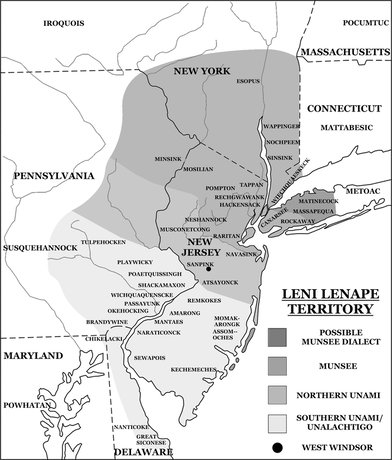
A crude map of Lenape territory.
|
European Acquisition
|
Giovanni da Verrazzano’s 1524 exploration of New Jersey’s coast proved a portent for later developments. Starting in the early 1600s, predominately Dutch settlement in New Jersey saw the colony’s first regular “New World”-“Old World” interactions. But in 1664, the fate of “Nova Caesarea” changed forever, upon the takeover of the colony by the English. Roughly three decades later, the first large land purchases in what would become West Windsor – by William Penn (famed Quaker founder of Pennsylvania), David Lyell, and New Jersey governor Andrew Hamilton – began to define the boundaries of our township. Penn-Lyle Road, built along a division line that separated these parcels, still memorializes William Penn and David Lyell, after whom it was named.
|
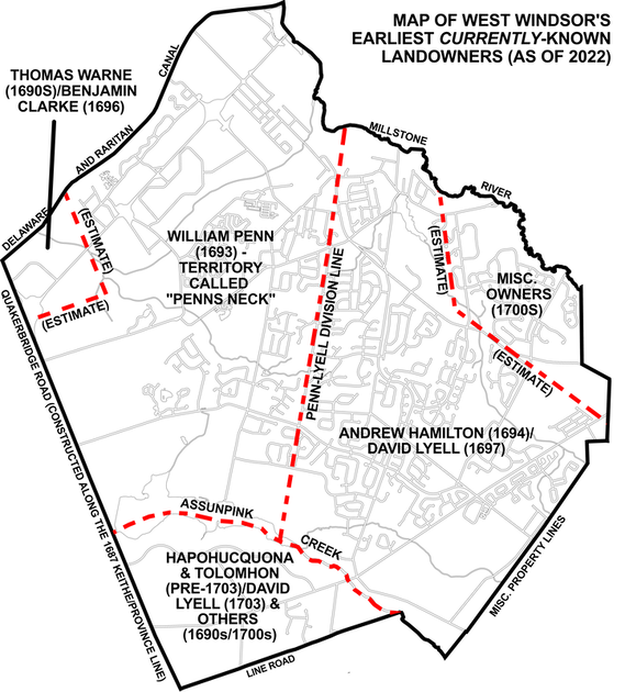
This map shows local landownership in the 1690s/early 1700s.
|
Colonial Settlement
|
Although West Windsor’s very first settler has not yet been identified (research is ongoing), by the 1730s (and perhaps as far back as the 1690s), a few individuals called the area home. In 1737, several land purchases saw the establishment of two of West Windsor’s historic communities – Dutch Neck and Penns Neck. However, there were also several other hamlets – Clarksville, Edinburg, Grovers Mill, Aqueduct Mills, and even much of Princeton.
Yes, Princeton. In 1730/31, “New Windsor” township was informally established, encompassing virtually all of present-day West Windsor, East Windsor, Robbinsville, and Princeton (southeast of Nassau Street). A community reliant on farming (and in some cases, slavery), New Windsor – officially incorporated in 1750/51 as “Windsor Township” - flourished due to fertile soil and access to larger cities such as Trenton. |
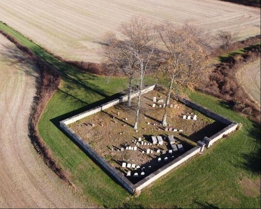
The Schenck-Covenhoven cemetery is a mid-1700s remnant of WW's first large wave of settlement.
|
|
Revolutionary Times
Yet Windsor was not completely free of conflict. Amid the American Revolution, dozens of Windsor Township residents enlisted. The conflict hit home before, during, and after Battles of Trenton and Princeton in late 1776/early 1777. Through these battles, the Continental Army achieved much-needed victories, repelling the British, reinvigorating the troops, and providing a lifeline for the American cause. Following the war, life in Windsor resumed. However, by the 1790s, a movement grew to split the town in half. Thus, on February 7, 1797, Windsor Township officially split into East Windsor (including present-day Robbinsville) and West Windsor (including all land up to Nassau Street). |
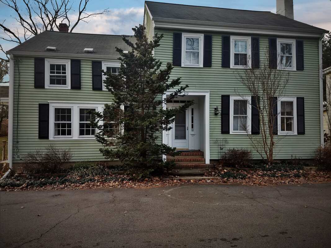
This house at 212-214 South Mill Road was once a tavern that hosted the first West Windsor Township meetings in 1797. Click to learn more!
|
Nineteenth Century Developments
|
In the ensuing decades, major transportation arteries arose to supplement colonial byways. In 1804, the Trenton-New Brunswick Turnpike (Route 1) was chartered. The Delaware & Raritan Canal opened for intrastate commercial trade in 1834. And in 1839, the Camden & Amboy Railroad opened a branch in town along the canal, connecting West Windsor to a statewide system. These led to the establishment of yet more communities – Princeton Basin and Port Mercer – and further local growth.
Princeton split from West Windsor after land annexations in 1838 and 1853 shifted our community’s western border to the canal. The town evolved further following the 1863 relocation of the railroad to its current route (now called the Northeast Corridor). While this spurred the economic decline of the canal, it prompted the growth of another West Windsor community - Princeton Junction – around the train station. |
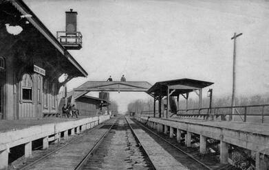
The Princeton Junction train station c. 1870s.
|
Twentieth Century Expansion
|
In 1917, Dutch Neck and Penns Neck Schools replaced the small schoolhouses that had served West Windsor’s youth for centuries. Berrien City, our town’s first planned development, rose just south of the train station in the 1920s. And concurrently our two volunteer fire companies were also established.
From the 1920s-50s, municipal government expanded to feature more specialized positions and respond to population growth – from around 1,400 residents in 1920 to 2,500 three decades later. Zoning and Planning Boards were established, a Master Plan was adopted, and the first mayor took office as leader of the centuries-old Township Committee. Amid this period, West Windsor entered the national limelight during Orson Welles’ 1938 “The War of the Worlds” broadcast, which pinpointed Grovers Mill as the site of a Martian landing. |
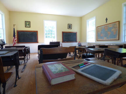
The Schenck Farmstead's schoolhouse shows where classes were held before 1917.
|
|
Suburban Growth
Following World War II, several suburban developments rose among the farmland and population grew. In response, in 1969, the West Windsor-Plainsboro School District was established, replacing the old township SCHOOL district set up in the late 1820s. Maurice Hawk and High School South opened in 1964 and 1973 (respectively), and in 1977 the old Town Hall in Dutch Neck was torn down, replaced by the current municipal center on Clarksville Road. But the most dramatic change was yet to come. Between 1980 and 2000, West Windsor’s population surged from ~8,500 to ~22,000 residents. The town’s formerly agrarian identity transformed dramatically into suburbia. Its government restructured in 1993 to a nonpartisan Mayor-Council format. And its demographics evolved, seeing dramatic ethnic, racial, ideological, and religious diversification. |
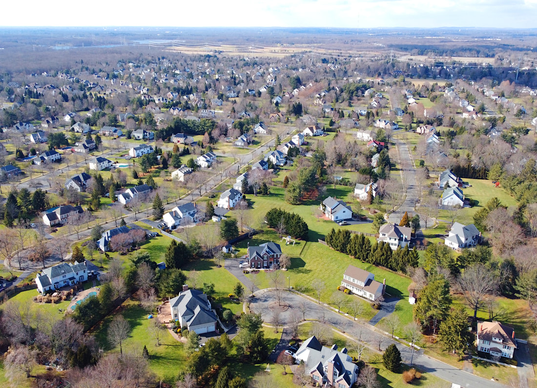
Typical single-family housing landscape in West Windsor in 2022.
|
West Windsor Today
|
Unfortunately, a byproduct of this population expansion was the loss of historic farmland and dozens of centuries-old dwellings. Yet still hidden among all this recent growth are hundreds of sites, remnants from our predecessors. While West Windsor today is a thriving suburban municipality of tens of thousands of residents with a dramatically altered identity, its unique history and rich heritage are still visible, evoking the stories of centuries past.
Come and learn about this history at the West Windsor History Museum! |
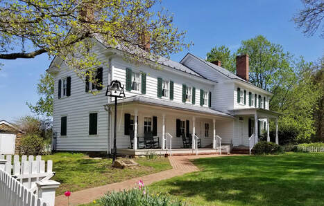
The Schenck Farmstead still stands today, bridging West Windsor's past, present, and future.
|

