The Aqueduct at Scudder's Mills
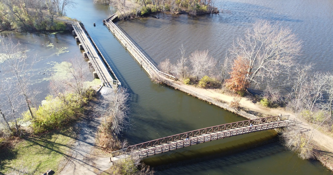
The Aqueduct, November 2020. From Paul Ligeti.
Historical Overview
|
A large concrete and wood structure stands at the confluence of Carnegie Lake and the Millstone River, carrying the historic Delaware and Raritan Canal over both bodies of water. This conduit - traditionally called "the Aqueduct" - is a longtime fixture of the historic Plainsboro/West Windsor community of Scudder's Mills. It is also the structure after which Scudder's Mills' alternative name - Aqueduct Mills - derives.
The aqueduct (perhaps originally a wooden structure) was first erected some time just before the opening of the canal in 1834.[1],[2] The canal was excavated to facilitate the transportation of goods between Bordentown and New Brunswick. Millions of tons of cargo were shipped annually during its heyday in the mid-1800s.[3],[4] The Aqueduct itself allowed boats to safely traverse the intersection of the Stony Brook (flooded in 1905/6 to become Carnegie Lake[5]) and the Millstone River, while minimizing the impact on the flow of these two water bodies. |
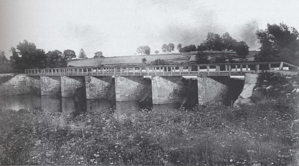
The Aqueduct prior to 1907.
|
|
A new aqueduct was constructed a bit north of the original one in the spring of 1868 and the original was largely demolished (although its footings may still be under the river). This new structure was twice as wide, more structurally sound, and had less of a pronounced curve.[6],[7]
The Delaware and Raritan Canal declined after 1863, when the present-day (2024) Northeast Corridor opened as a competitor.[8] Its last profitable year was 1892,[9] it fully shut down after the 1932 shipping season,[10] and it was taken over by the state of New Jersey in 1934.[11] Although the construction of Carnegie Lake in 1905/6 led to worries about the aqueduct's stability, the structure held.[12] Repairs were performed around 1944[13] and in 1989.[14] In 1973, the canal was added to the National Register of Historic Places.[15] The next year the Delaware and Raritan Canal State Park formed.[16] |
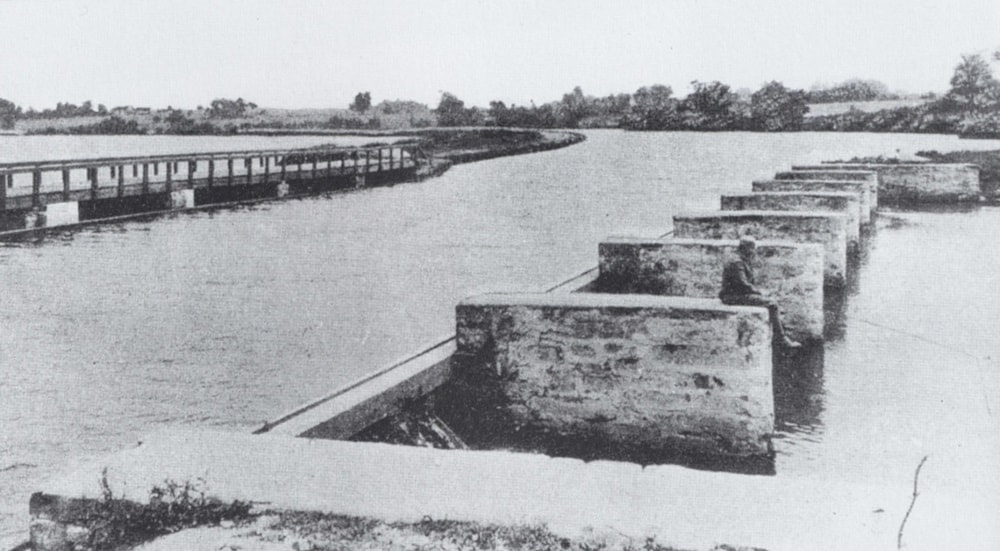
The Aqueduct, early 1900s.
|
Over the decades, the canal has become a popular park for fishing, biking, hiking, canoeing, and more. Some time between 1997 and 2002, a wooden pedestrian walkway was added to the Aqueduct's southeastern piers to continue the path on the east bank of the canal.[17],[18] It is a popular fishing spot to this day (2024). Although the canal no longer runs, and the Scudder's Mill community has long died out as a residential neighborhood, the Aqueduct remains.
Bibliography
- "Delaware and Raritan Canal." Princeton Whig. August 29, 1834.
- William Gulick, John C. Schenck, and George T. McDowell. (1836, November 259) "Valuable Mill Property At Auction." Princeton Whig.
- "National Register of Historic Places Inventory - Nomination Form - Delaware and Raritan Canal," December 13, 1972.
- Chirco, Vicki. “A Historic Place.” D & R Canal. Accessed January 29, 2024. https://dandrcanal.org/history.
- "Description of Proposed Carnegie Lake." Daily Princetonian. January 18, 1905.
- "Middlesex Courts." Princeton Press. September 20, 1873.
- "Middlesex Courts." Princeton Press. September 27, 1873.
- "Camden and Amboy Railroad/Delaware and Raritan Canal Companies Minutes of the Joint Board of Directors and the Executive Committee, 1831 - 1872,” n.d. Located at the New Jersey State Archive’s Manuscripts Room. Accessed February 28, 2022.
- "National Register of Historic Places Inventory - Nomination Form - Delaware and Raritan Canal," December 13, 1972.
- Ibid.
- Ibid.
- "Clippings Reveal Student Contention over Carnegie Lake." Princeton Recollector. July 1977.
- Larson, Morgan F, Administrative report of the commissioner of conservation for the period july 1 to december 31, 1945 § (1946).
- "Canal projects, aqueduct repair on in franklin." Central Jersey Home News. April 7, 1989.
- "National Register of Historic Places Inventory - Nomination Form - Delaware and Raritan Canal," December 13, 1972.
- "Raritan Canal a State Parksite." Newark Star-Ledger. October 11, 1974.
- “West Windsor Aerial Photography Composite Map, 1997.” Map. Historical Society of West Windsor - Map Archives. West Windsor, NJ, 1997.
- “West Windsor Aerial Photography Composite Map, 2002.” Map. Historical Society of West Windsor - Map Archives. West Windsor, NJ, 2002.

